MIMS RANGER
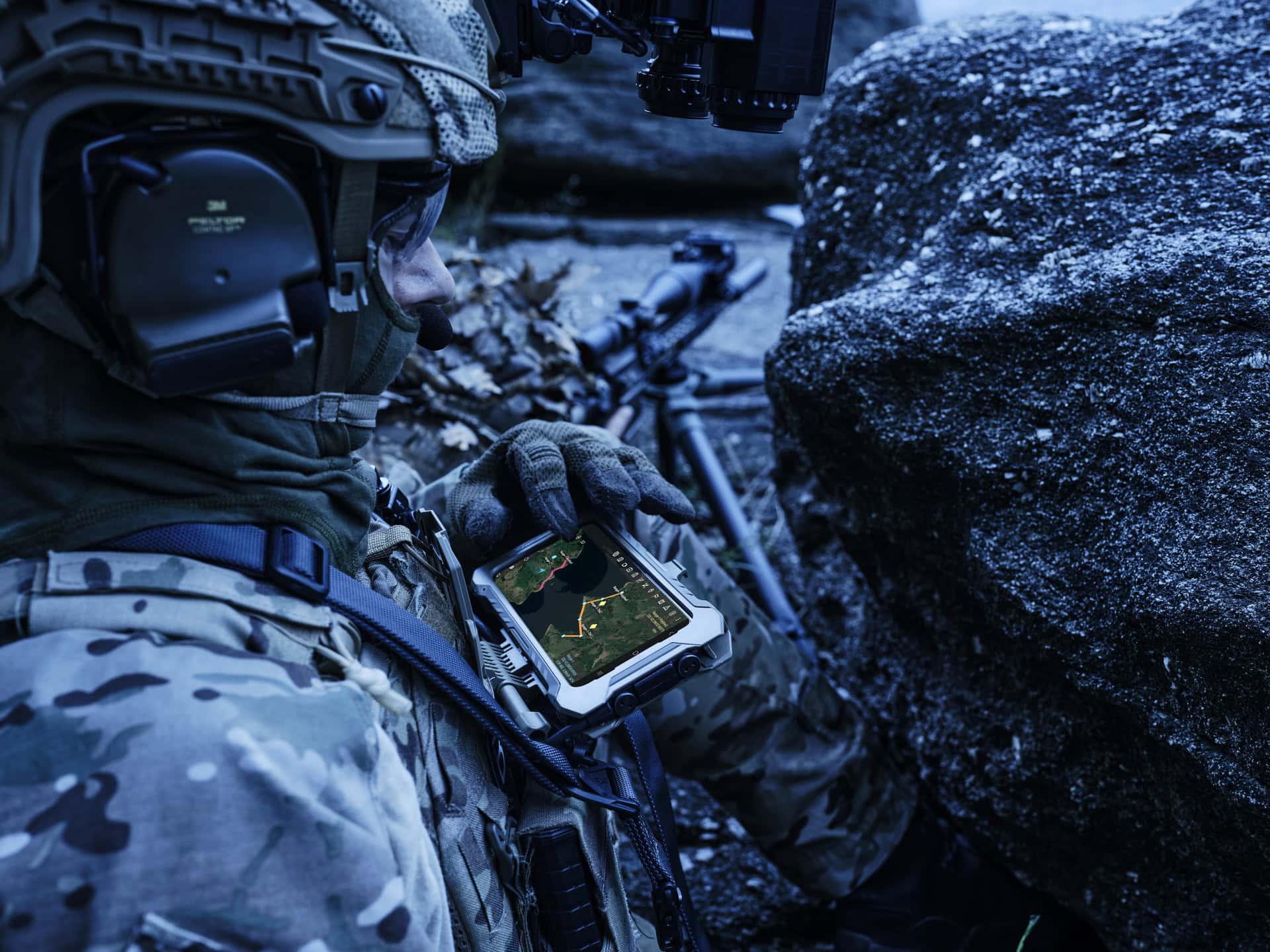
Designed and developed as an optimal Tactical solution to provide all-round Situational Awareness and operational support for various Missions, it empowers Special Operations and Dismounted soldiers in achieving Battlefield dominance.
/ Connectinc the Battlefield

/ MIMS Ranger Applications
Blue Force Tracking (BFT)
Mission planning
HALO/HAHO free-fall calculation and navigation
Route planning and navigation
Maritime Interdiction Operations plugin IAW NATO ATP-71 procedures
MEDEVAC, CASEVAC report creation
Emergency message exchange (predefined or parameterized to/by the user)
Instant messaging (IM) among the users
Support of 3D maps
Cooperative targeting (target info dissemination to the participants)
Real-time video transmission/reception
File transfer
FUNCTIONALITIES & KEY FEATURES
Through the fog and clouds
Special Operations Teams can stay connected and share critical information as assignments unfold. Leaders can make better decisions through better and faster data. It can track everyone’s positions and movements through GPS. It can also capture, distribute, and view full-motion HD videos to investigate, coordinate, and complete the mission. MIMS presents special features to support HALO/HAHO jump execution/navigation and maritime interdiction operations. MIMS also provides flexibility with Various Map formats and coordinate systems in 2D and 3D.
Configurable
New plugins and functionalities can be developed according to the end user’s special operational requirements. Future upgrades to adapt CONOPS evolution, including the necessary client support, are also possible.
Turn-key Solution
A turn-key and battle-ready solution for the modern warrior, the MIMS Ranger combines software supremacy, alongside the world’s best smart tactical radios.
Force Multiplier
It provides an integrated solution to increase battle effectiveness and support Special Operations.
Situational Awareness
The MIMS Ranger increases situational awareness and decision-making in the field.
Capabilities & Features
Own position indication and visualization on the map
Exchange of Media messages (image/video) supported by text
Exchange of Tactical Objects (tracks, points, areas, polylines)
Display images and video
Tactical aids through sight and distance measurement functionalities
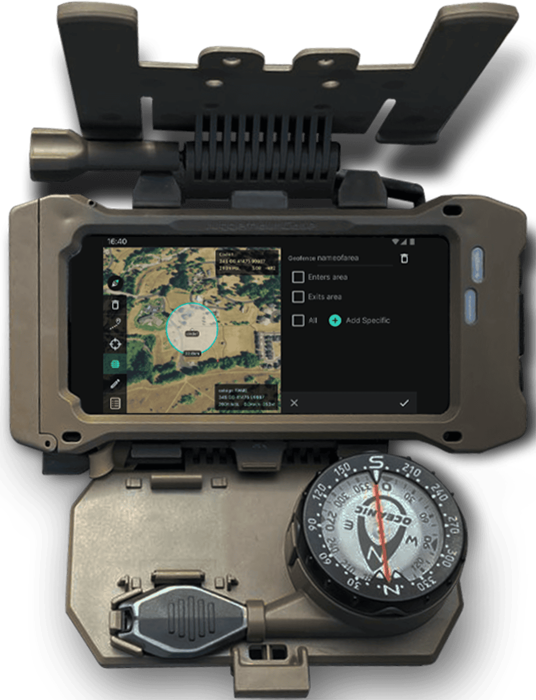
Geofencing
Coordinates conversion (WGS84, MGRS, DMT, DMS, UTM)
Instant messaging (IM) among the users
Support of various map formats
Import map layers for specific mission requirements
Tactical Situation Display with advanced Graphical User Interface
Highly integrated with C2 systems